pdfDoW⌕ Searchable transcript
DOW-UAP-D42-Range-Fouler-Debrief-Japan-2023
DOW-UAP-D42-Range-Fouler-Debrief-Japan-2023 — a DoW document (2023) from the U.S. Government's AARO / PURSUE UAP disclosure releases. Hosted here in full.
Page-by-page transcription
Searchable text extracted from the original 1-page scan. The page images are the authoritative source; the text is machine OCR and may contain artifacts. Also available as downloadable JSON.
1 pages · machine OCR from the original scan
PAGE 1 / 1
0 cl
rM· 1tted
c
v Ml Ric{{..;,. d (\ IH rr '>Of'
U
easJN o not ûser. tle,,.J?,-irp e
•
., su6hirf '&uf üý þÿov,e'":'Ā $aJJe and
[ 1 r I āsilirH, J,1 ltl r'Wri,' G: b If
Range Fouler Debrief Form f- 1uol1;<l!!'J"1eL_
o)qp1l
9s
manua y
1
\See ue ow.
Please complete this form to the best of your ability. If you do not have the requested information,
please leave the fiĂld blank. If there was more tăĄn one "group!" ąleĆse repćrt each on a separate
form for data collection purposes. You should receive a response within 5 business days.
Last Name, First Name
Rank
0-2
Squadron
j482ATKS
Sf PR Email Address
Crew Position
Pilot
This information is for contact only. SPEAR sanitizes all rĈports of identifying information.
Absolutely no identifying information for aircrew or squadr ! n will be recorded for analysis.
08/31/20
Dusk
Date (mmldd,YY)
Time of detection
Day I Ni;:,ht
{tlh:mm:ss Z)
Contact Worl<ing Area
(Ex: W-72 1A)
{b)(1)Ua
Contact Latitute
(DD:MM:SS)
Side No.
Buno
N/S
Contact Longitude
EMI
(0D:MM:SS)
Please attempt to determine a Lat I Long for the contact at initial detection. We recommend
using JMPS to reference the sensor-derived bearing· and range relative to the bullseye you had
in use. If that method is not available. any reasonafJ/e derivation of location will worl<, but please
be as specific as possible and make a note in the comments section. These locations may be
used to cue other means of tracking.
Radar Equipped: Other
Stable Trackfile?:
# of Contacts in "Group":
EA Indications (Check af/ that apply):
□
ECM
An:
□
Letter
tdenlifii,r □ □
False
Other/
Trackfiles
Ambiguous
AIM-9x Self-Track:
A TFL/R Autotrack:
• Tally Achieved:
□
□
□
ISR
Mission Description (GAS, BFM, etc)
No
LFE?
118000
Contact Altitude
( x: 22000)
Yes
Altitude
Constant?
Wind Dir at
Contact Alt
(From)
Was the contact moving?
Direction/Speed
(Ex. 090/15)
Wind
Speed
Yes
150/230
Please check all that apply:
Round: D
Square: D
Balloon-shaped: D
Wings/Airframe: D
Other Shape:[Z]
Apparent Propulsion.@
Moving Parts: D
Metallic: D
Markings: D
Translucent D
Opaque: D
Reflective: D
Plesse use the field below to describe the contact and any inte.1action in your own words with as much
detail as possible. Ple.ase be sure to include any detail not inc/
I
ded in questions above.
MGRS Grid of initial contact: 39RWL2fijij.1:Mlm]a
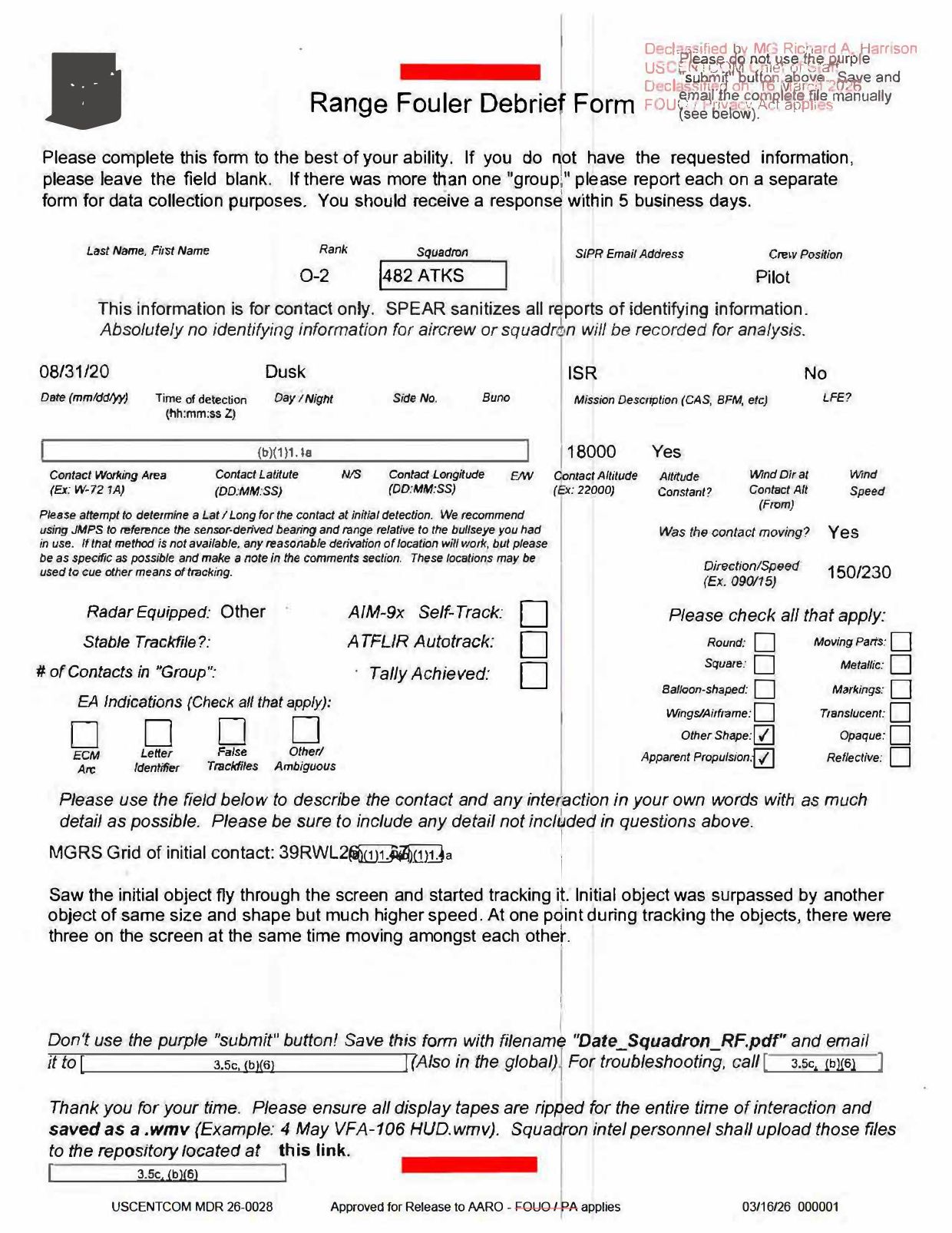
Saw the initial object fly through the screen and started tracking i . Initial object was surpassed by another
object of same size and shape but much higher speed. At one p4int during tracking the objects, there were
three on the screen at the same time moving amongst each other.
I
Don't use the purple "submit" button! Save this form with fl/enaml "Date_Squadron_RF.pdf" and email
it to I
3.5c, (bl{6l
I (Also in the global)ú For troubleshooting, call I
3.5c, <b)(6) I
Thank you for your time. Please ensure all display tapes are ripJed for the entire time of interaction and
saved as a . wmv (Example: 4 May VFA-106 HUD. wmv). Squa ron intel personnel shall upload those files
to the repository located at this link.
f
3.5c. {b)(6)
I
USCENTCOM MOR 26-0028
Approved for Release to MRO. FOUO / PA applies
03/16/26 000001
Original document
Record Data
Agency
DoW
Type
Document (pdf)
Year
2023
File size
289 KB
Release
Season 01
Hosting
Hosted on this site
U.S. Government work · Public domain · Part of the AARO / PURSUE releases.